↓ Download a PDF of this issue
The art of a DBM: A new online short course
By James Hrynyshyn
While the design basis memorandum (DBM) has been around for decades in other fields, it’s probably a safe bet that few mine closure engineers have been asked to write one.
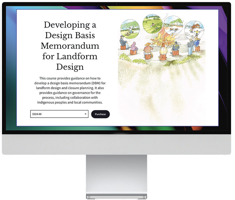
As part of the LDI’s efforts to make DBMs commonplace in landform design, the Institute is now offering a new online “short course” on how to create one. The course includes eight video lectures recorded by the Institute’s founder, Gord McKenna. Each lecture and its accompanying exercises cover one element of the process, from crafting an appropriate vision and writing the actual document to implementing the measures it contains.
The course provides direction on assembling a design team comprising specialists who can develop a vision and a master table of goals, objectives, and criteria. It sets out instructions on the governance of the design process, including collaboration with Indigenous Peoples and local communities, and offers a community forum to discuss course material with other practitioners.
Students complete three exercises that will be evaluated by a landform design expert within 14 days. Those who complete the course will receive a DBM certificate.
According to McKenna, the expectations of mining companies, regulators, and local communities regarding the design, construction, and performance of reclaimed lands are frequently misaligned, but without direction, addressing this problem is nearly impossible. “An effective DBM ensures all stakeholders are working together toward shared goals and objectives,” he says. “What this course does is give engineers the ability to create one.”
The fee for the course is $399 for nonmembers of the LDI. Members enjoy a 20% discount, which makes the cost $319 for each student, individual member, or members employed by a corporate member. Registrants can take advantage of the discount by registering as LDI members for $90 as individual members or $10 for students.
The core text for the course, the recently released how-to guide Developing a Design Basis Memorandum for Landform Design, is available at no charge here. Members have access to supplementary information.
James Hrynyshyn is a writer and editor with West Hawk Associates
Season 3 of Getting Closure now streaming
The third season of Getting Closure, a podcast produced by the LDI, wraps up this winter with an exploration of the myriad possible uses for an abandoned mine.
In the latest episode, host and LDI Director Mike O’Kane talks with Peter Whitbread-Abrutrat, the co-author of 102 Things to Do With a Hole in the Ground and a leading proponent of progressive and sustainable mine closure. From his home in Cornwall, UK, Whitbread-Abrutat leads Future Terrains, a team of reclamation specialists and landscape architects tasked with reclaiming degraded lands by enhancing environmental and social performance and promoting landscape restoration.
Their conversation also extracts some of the lessons from the Eden Project, which, with Whitbread-Abrutat’s scientific guidance, turned what used to be a china-clay pit into the world’s largest indoor rainforest.
In other episodes this season, O’kane sat down (literally or through the Internet) with:
- Geoff Beale of Piteau Associates, a global firm providing geotechnical, hydrogeological, and environmental consulting services
- Christine Daly, an LDI board member and specialist in “co-reclamation” in collaboration with Indigenous Peoples and local communities
- Guy Boggs, chief executive officer of Australia’s Cooperative Research Centre for Transformations in Mining Economies and an authority on what happens economically, socially, culturally, and environmentally after mining ends
- Priscilla Nelson of The Tailings Center, an industry/ university research and education collaboration between the Colorado School of Mines, Colorado State University, and the University of Arizona.
The season also includes a special series of three episodes in which O’Kane and LDI Founder Gord McKenna delve into the details of the 12 Principles of Landform Design. Each episode deals with four of the principles, using examples from O’Kane and McKenna’s many decades of experience. Getting Closure is available on all major podcasting platforms and on the web at landformdesign.com/podcast.
New student award
Students in an accredited post-secondary program related to landform design or one of its disciplines and holding membership in the LDI will soon have a chance to win a $500 award. The requirements are simple: fill out an application and answer the question “What is your perspective of landform design and how would your membership with LDI contribute to your future professional career development?” The deadline for applications is November 30, 2025. More at landformdesign.com/award.
How the DBM guide all came together
One of the 12 principles of landform design calls for the creation of a design basis memorandum (DBM) for each landform design. Soon after launching the LDI, its founders realized they would need to do more to encourage landform designers to embrace DBMs — they would have to provide specific guidance on how to produce one.
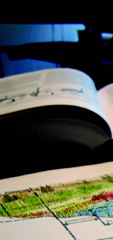
The resulting document, Developing a Design Basis Memorandum For Landform Design, is the product of almost two years of work by a dedicated team of writers and editors, an illustrator, and reviewers. Although the guide explains how to develop a standalone document for an individual landform, it is just as applicable to a mine closure plan, in which the DBM may form just one chapter.
For many years, DBMs have been used in other disciplines, such as commercial and industrial projects, to capture the design inputs, principles, and rationale relevant to the given project, as well as the required design and performance outputs. A literature review undertaken for the guide revealed that most DBMs have a similar general format that includes:
- a major section on pertinent background information (including site conditions, climate and geography, regulatory requirements, corporate commitments, constraints and schedules, and a declaration of longterm monitoring and maintenance requirements);
- a vision for the reclaimed landscape;
- a large section or table of nested goals, objectives, and design criteria in support of the objectives, all written with an eye to achieving the vision.
An effective DBM for a landform design should be relatively concise — 10 to 20 pages long — and be developed over several weeks. It becomes the guiding document for subsequent designs and is updated over time with new learnings and performance data as expectations and preferences for the reclaimed landscapes evolve.
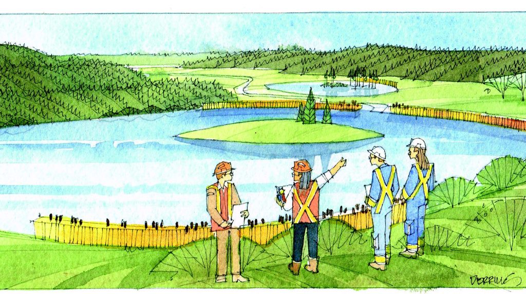
The LDI guide also provides guidance on governance for the process, including collaboration with Indigenous Peoples and local communities. It describes the composition of the landform design team. It provides practical advice, along with examples of landform design visions, typical goals, the level of detail needed to document the design inputs and background information, and direction on how to assemble a Master Table of goals, objectives, and criteria. A complete example of a DBM for a simple, hypothetical mining landform, along with references to the few available DBMs that relate to mine reclamation, are also included.
Although the document is applicable to projects worldwide, much of the context has a Canadian focus, reflecting the experiences of several of the writers and in consideration of Canada’s unique Indigenous communities. For example, the worked example of a DBM for landform design profiles a hypothetical coal mine in the foothills of the Rocky Mountains in Alberta, Canada.
EXCERPT
An introduction to the Design Basis Memorandum
From LDI. 2024. Developing a Design Basis Memorandum for Landform Design. Report TR-02. Landform Design Institute. Delta, BC, Canada. 84 pp.
Landform design is the interdisciplinary process used to build mining landforms, landscapes, and regions, and to meet agreedupon land-use goals and performance objectives. It was first developed in the 1990s to address the concern that, despite the best efforts of mine reclamation practitioners, mining companies, and regulators, almost no one was achieving signoff on even wellreclaimed land. One of several reasons for this lack of signoff is poor alignment among the mining company, the regulator, and the local community regarding expectations for the design, construction, and performance of reclaimed lands and the reclaimed mine site overall.
In response, the landform design process has been developed and tested at dozens of mines over the past 30 years. In 2019, the Landform Design Institute (LDI) was formed to provide practitioners with the how-to tools and resources to practice landform design. The Institute is focused on helping mines and practitioners close the gap between what is being promised and what is being delivered for reclaimed mine sites. One of the 12 principles of landform design is to create a design basis memorandum (DBM) for each landform design. A DBM, also often referred to as a design basis report, or simply a design basis, is a concise document, prepared under the leadership of the landform design team, for every landform design. It contains background information about the site, a precise listing of all the design inputs, the vision for the reclaimed landform or mine site, and a nested list of the design and landscape performance goals, objectives, and design criteria needed to support the vision. It is used to gain broad acceptance for future designs and assessments of the landform or landscape by the landform design team, mine management, Indigenous and local communities, and the regulator. It is a living document, one that co-evolves over the years and decades of design and mining / mine reclamation activities. Ideally a DBM would be developed for each mine closure plan and for each mining landform before disturbance begins. However, it is likely that most practitioners will be developing DBMs for existing mining landforms, each of which will be at a different stage of the mining life cycle.
DBMs are commonly used in other industries but have been underutilized in landform design and closure planning. Various forms of DBMs have been applied at a few mine closure and reclamation projects since the 1980s. For some mining companies, producing a DBM for landform design is now becoming routine, and some have produced internal standards for its development. For others, it is a novel approach to landform design.
Few DBMs are publicly available, and as a result numerous practitioners have requested that the Institute provide detailed guidance on how to craft one and provide successful examples. This document is the first edition of DBM guidance for use by landform design practitioners, regulators, and local communities. It includes a sample table of contents and a worked example. Our website, landformdesign.com provides additional publicly available examples.

A successfully established DBM results in a comprehensive, complete design and a governance team established for the life of a landform. The document includes a list of key references, corporate and regulatory requirements, and commitments to stakeholders. The DBM will feature a clearly defined set of end land uses, vision, goals, design objectives, and design criteria. These are all agreed upon by the mine, relevant government agencies, regulators, and Indigenous and local communities. A brief, living document, signed by all affected parties, will guide the design and operational decisions for the coming decades, leading to the achievement of the vision and the goals. The document acknowledges what constitutes acceptable costs and acceptable levels of residual risk.
When most mines worldwide begin actively using DBMs for their landform designs in the coming years, then the Institute’s mission — making landform design routine in the mining industry — will have been largely accomplished.
Developing a Design Basis Memorandum for Landform Design can be downloaded from here.
DBM workshop added to Mine Closure 2025
Reading a guide on how to assemble a design basis memorandum (DBM) is a good — and essential — first step. The LDI can do you one better if you happen to be attending the year’s premier reclamation conference in Luleå, Sweden, this September. The organizers of Mine Closure 2025 have added a full-day workshop, “Developing a Design Basis Memorandum for Mine Reclamation and Closure,” to the conference agenda.
The workshop will be offered on Monday, Sept. 22, the day before the full conference begins. It will be led by Justin Straker, the chief technical officer of the Integral Ecology Group and a new member of the LDI Board of Directors (see page 8), and Mike O’Kane, senior technical adviser of Okane Consultants and a member of both the LDI Board of Directors and its Technical Advisors panel.
Participants in the workshop can expect to learn about the benefits and key components of a DBM and collectively work through the development of one for a reclamation and closure project. Themes to be addressed during the session include:
- Introduction to the DBM approach, and why it is important to reclamation and closure planning
- Main sections of a DBM
- Scales and scopes of DBMs, for both site-wide and facility-level reclamation and closure planning
- Who should participate in developing the DBM, with a focus on collaboration with Indigenous communities or other rights holders
- Steps to developing a DBM
- Setting a design vision, and goals, objectives, and criteria
- What does “good” look like for a DBM?
- Change management and DBMs
Each workshop participant will be provided with a hardbound copy of the LDI’s newly released guide, Developing a Design Basis Memorandum for Landform Design. This guide provides instructions on how to set a vision for a reclaimed landform or mine site, including establishing the goals, objectives, and design criteria needed to support that vision. The new guidance document is intended to be used for the design and assessment of individual landforms and for site-wide closure planning.
Mine Closure 2025, which runs Sept. 23–25, is organized each year by an international committee headquartered at the University of Western Australia, in Crawley, WA. The host insitution this year is the Luleå University of Technology and the conference chair is Sven Knutsson, an emeritus professor of soil mechanics at the university.
The full agenda will be set later this year. More information on the confeence, past proceedings, and registration details can be found online at acgmineclosure.com/2025.
The importance of a landform design life
The Design Life of a Mining Landform is a forthcoming report from the LDI that provides a rationale for mines to declare a design life — the period a mining landform would be expected to perform as intended before rehabilitation or replacement become necessary. This is a preview of the document.
By Gord McKenna
Mining practitioners have made significant efforts trying to determine how well mining landforms will perform long after all the ore has been extracted. Some clarity might come from making a “design life” a common element of mining landform designs.
A design life counters the assumption that a reclaimed mining landform can act as intended in perpetuity without maintenance or major investments. In reality, few landforms will perform as desired without maintenance. All landforms evolve physically, chemically, and biologically. The timelines for features such as tailings facilities, mine rock stockpiles, pit lakes, or surface water draining systems will extend to hundreds or thousands of years. Societal expectations and land uses also evolve. Generating a mining landform design life also helps determine the financial requirements of monitoring and maintaining the landscape, which could extend hundreds of years into the future.
The notion of a design life for mining landforms extends back at least three decades, beginning with the Uranium Mill Tailings Remedial Action project in the US. At the time, engineers, scientists, and policy-makers were struggling to design tailings repositories that would perform as intended for hundreds or thousands of years. While progress has been made, little credible guidance exists on how to devise a mining landform design life or what kind of time frame is appropriate. However, several organizations, including the International Commission on Large Dams, agree that a 1000-year time frame is reasonable.
Like natural landscapes, mining landforms change and evolve over time due to natural processes and the effects of climate change. A stable and maturing ecological system may be manageable, but a landslide or dam breach could be catastrophic. Geologists and ecologists can anticipate such changes, while regulators and stakeholders often argue that geotechnical stability needs to be the intended objective of the landforms.
Practitioners can use a design basis memorandum (DBM) to set out the vision for a reclaimed landform and specify its goals and objectives, including a design life. In November of 2024, the LDI published a guidance document on how to research and write a DBM, which should account for a design life. For example, mine practitioners may need to use artificial materials with a design life shorter than that of the overall mining landform. Such elements should be specified in the DBM, along with how the landform will perform as these elements break down.
Numerous factors continue to undermine the ability of practitioners to promise sound and perpetual landscape performance, even with planned monitoring and maintenance. The first step is specifying a design life, based on the best available science and case studies.
Gord McKenna is founder and chair of the Landform Design Institute.
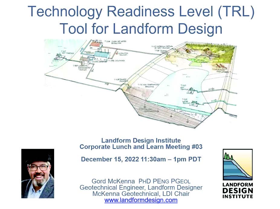
NEXT LUNCH AND LEARN:
Implementing landform design at your mine
The LDI’s popular Lunch and Learn series continues Feb. 18, 2025, with a session devoted to implementing landform design at specific mine sites. This will be the sixth Lunch and Learn with LDI Founder Gord McKenna. Each Lunch and Learn is initially delivered exclusively to corporate members, and video recordings, including question-and-answer sessions, are later made available to the public here.
Straker joins Board of Directors

Justin Straker, founder of the Integral Ecology Group in Duncan, BC, has joined the LDI board of directors, beginning with the board retreat held at the University of Calgary on Nov. 14 and 15, 2024. Straker is a soil scientist and forest ecologist with more than two decades of experience in applied terrestrial ecology. Straker focuses his practice on reclamation of surface-mining disturbances, including design, implementation, assessment, review and regulatory inspection of reclamation and reclamation-research programs; assessment of the cumulative effects of human activities on ecosystems; and assessment of environmental effects of industry (e.g., air pollution) on terrestrial ecosystems. Straker has worked throughout Canada, Alaska, South America, and South Asia. He has a bachelor’s degree in anthropology from McGill University, and a master’s degree in soil science from the University of British Columbia.
AGM scheduled for February 19
The fifth Annual General Meeting of the Landform Design Institute will take place Wednesday, February 19, from 5 to 6:30 pm MST (7 to 8:30 p.m. EST). Dr. Gord McKenna, Chair of the Institute, will host the online meeting. All members are invited to attend. The keynote speaker will be Peter Whitbread-Abrutat, the founder and director of Future Terrains (see page 2) and co-author of 102 Things to Do With a Hole in the Ground. All members are invited to attend the Zoom meeting. Details can be found under the Operations section of the members’ site at landformdesign.net.
Return of the video vignettes
The LDI’s first 14 Video Vignettes, short presentations to provide insight and guidance on a single landform design issue, proved popular enough to warrant a return to the camera. The vignettes, which are between 7 and 15 minutes long, are delivered by LDI founder Gord McKenna. New vignettes will be posted to the members site (landformdesign.net) on a regular basis throughout 2025.
© 2025 The Landform Design Institute
The Landform Design Quarterly is a publication of the Landform Design Institute, a not-for-profit corporation based in Vancouver, BC. All contents are protected by copyright and may be used only for non-commercial purposes. All other rights are reserved and commercial uses including publication, broadcast, or redistribution in any medium are prohibited. Permission to copy may be sought from the Landform Design Institute. © 2025 The Landform Design Institute.
Publisher: Landform Design Institute
Editor: David Wylynko, West Hawk Associates
Designer: James Hrynyshyn, West Hawk Associates
Illustrations: Derrill Shuttleworth